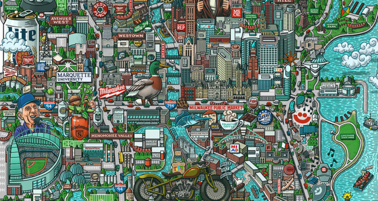
What is it about illustrated maps of Milwaukee that’s so fascinating, so captivating, so delightful? We have one from the ’70s hanging in our office, and many others have popped up over the years, too. Now, artist and illustrator Mario Zucca has entered the cartoon Milwaukee map fray with a whimsical and delightfully detailed creation that has to be seen to be appreciated. So here it is!
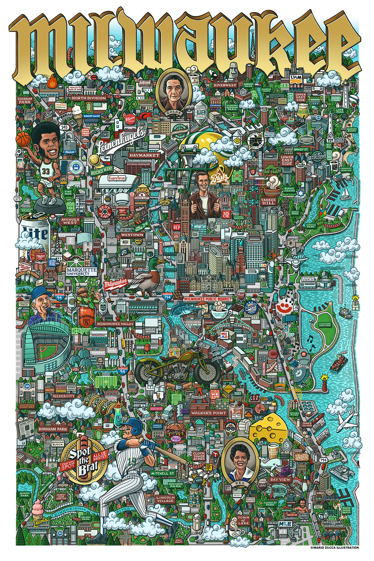
Phew! Where else will you find big attractions like American Family Field and the Summerfest grounds butting up against historical figures like Vel Phillips and Golda Meir, cryptid characters like Milverine and Gertie the Duck, and local gems like Zócalo Food Park and Cactus Club? Plus, Speed Queen and that “Welcome To Cleveland” sign! (We found six brats.)
Want a copy for yourself? Prints measuring 36″ x 24″ are available for $45.
Zucca lives in Philadelphia, and has been working as an illustrator for nearly 20 years. Thanks to a childhood love of detailed “seek-and-find” images and Where’s Waldo? books, he got into map-making about eight years ago. To date, he has created illustrated maps of cities like Detroit, Portland, and Pittsburgh. For the Milwaukee map, he sourced all the ultra-specific locations and references from travel sites, friends, and Reddit.
“I first visited Milwaukee last year with a friend and I fell in love with the place,” Zucca tells us. “I’ve drawn several cities now, but as a kid who grew up in the heart of the Rust Belt, I’ve always had an affinity for smaller, working class-type towns that are a little rough around the edges. The process for this map started with a lot of research. I consulted travel sites, talked to friends who are Milwaukee natives, asked for suggestions on Reddit. Once I got a lay of the land and the major landmarks I wanted to include, then it was a matter of plotting everything, planning the layout, etc.”
What’s next for Zucca? “I’m actually doing some updates to my Philadelphia map for a reprint. It’s where I live and the first city map I ever did,” he says. “I’ve also started my next city map. I don’t want to give too much away, but it’s another working class town in a similar vein as Milwaukee, Detroit, Pittsburgh, etc. I’m also starting to plan out my first full-state map! Whichever map is next, I hope to have it ready to go early next year.”
Want more Milwaukee Record? Subscribe to our free weekly newsletter and/or support us on Patreon.
RELATED ARTICLES
• Let’s take a close look at this ’70s-era cartoon map of Milwaukee and Southeast Wisconsin