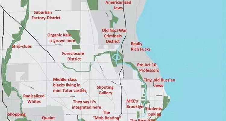
Milwaukee is a terrific city, filled with incredible music, amazing food, and approximately 8,000 places to enjoy a drink after all that music and food. (One might say “You Gotta Be Here!”) But it’s also a city of deep racial and economic divisions, with the Milwaukee metro area consistently ranking as the most segregated place in America. There are other, more frivolous divisions, too, like the differences between the cool kids in Riverwest and the cool kids in Bay View. All of those barriers—both fun and not-so-fun—are explored in a “Judgemental [sic] map of Milwaukee” recently posted to the city’s Reddit page. Here it is, in all its misspelled and button-pushing glory:
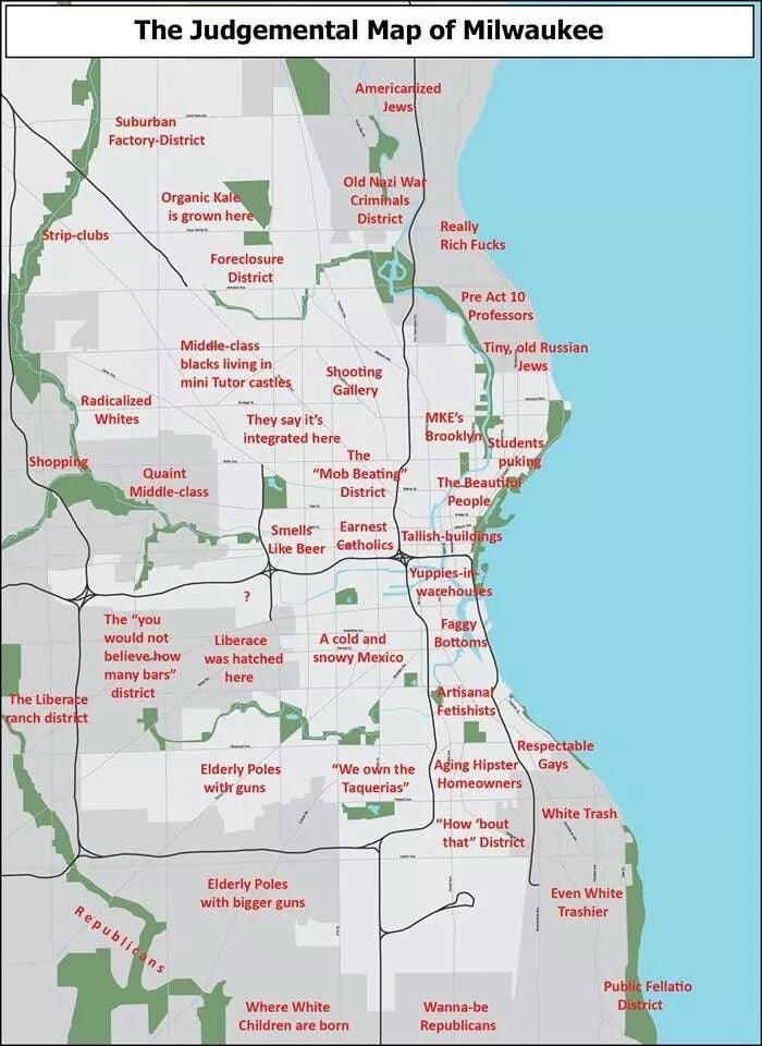
The creator of the map is unknown, though it’s clearly indebted to the “judgmental map” mini-craze kicked off by this website. Like maps for other cities, the Milwaukee map is a mix between lighthearted neighborhood descriptions (the East Side gets a “Students Puking” label, while Riverwest is deemed “MKE’s Brooklyn”) and more ugly, offensive ones (“Shooting Gallery”). There are also a few that simply don’t make any sense: Can anyone explain the “Old Nazi War Criminals District” or the “Radicalized Whites” area?
The map may ultimately be tongue-in-cheek (and more than a bit tired and lazy), but it does (sadly) illustrate how ingrained these neighborhood stereotypes are in the minds of Milwaukeeans. Is it human nature to mentally fence off different areas of the city? Sure. Is it important to remember that we don’t have to accept a divided city, and that we can all do a small part in bringing it together? Yes.